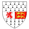
County Carlow
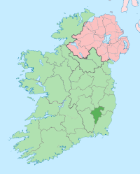
County Carlow (Irish: Contae Cheatharlach) is one of the twenty-six counties of the Republic of Ireland and one of the thirty-two counties of Ireland. It is located in the province of Leinster. It was named after the town of Carlow, which was bulit on the River Barrow. The population of the county is 50,349 according to the 2006 census.[1] Carlow is the 31st largest of Ireland’s 32 counties in area and 30th largest in terms of population.
People
| Historical populations |
| Year |
Pop. |
%± |
| 1653 |
4,969 |
— |
| 1659 |
5,434 |
9.4% |
| 1821 |
78,952 |
1352.9% |
| 1831 |
81,988 |
3.8% |
| 1841 |
86,228 |
5.2% |
| 1851 |
68,078 |
−21.0% |
| 1861 |
57,137 |
−16.1% |
| 1871 |
51,650 |
−9.6% |
| 1881 |
46,568 |
−9.8% |
| 1891 |
40,936 |
−12.1% |
| 1901 |
37,748 |
−7.8% |
| 1911 |
36,252 |
−4.0% |
| 1926 |
34,476 |
−4.9% |
| 1936 |
34,452 |
−0.1% |
| 1946 |
34,081 |
−1.1% |
| 1951 |
34,162 |
0.2% |
| 1956 |
33,888 |
−0.8% |
| 1961 |
33,342 |
−1.6% |
| 1966 |
33,593 |
0.8% |
| 1971 |
34,237 |
1.9% |
| 1979 |
38,668 |
12.9% |
| 1981 |
39,820 |
3.0% |
| 1986 |
40,988 |
2.9% |
| 1991 |
40,942 |
−0.1% |
| 1996 |
41,616 |
1.6% |
| 2002 |
46,014 |
10.6% |
| 2006 |
50,349 |
9.4% |
| [2][3][4][5][6][7] |
- Lisa Burke - weather forecaster on Sky News.
- Pierce Butler - soldier, planter, and statesman, recognized as one of United States' Founding Fathers. He represented South Carolina in the Continental Congress and the U.S. Senate.
- Myles Keogh - American Civil War military officer and later Captain of Company I, U.S. 7th Cavalry Regiment - Fought in Indian Wars and was killed at the Battle of the Little Bighorn in 1876. He was born in Orchard, Leighlinbridge in 1840.
- William Dargan - engineer, often seen as the father of Irish railways.
- Richie Kavanagh - comic songwriter, from Raheenwood, Fenagh, Co. Carlow.
- John Tyndall - the 19th century scientist who was the first to explain why the sky is blue.
- Saoirse Ronan - Oscar and Golden Globe nominated actress.
- Kathryn Thomas - RTÉ presenter.
- Samuel Haughton - Polymath, in 1866 published a formula for calculating the drop needed to cause instantaneous death at hangings.
Towns and villages
- Ballinkillen
- Ballon
- Ballymurphy
- Borris
- Carlow
- Clonmore
- Clonegal
- Fennagh
- Grangeford
- Hacketstown
- Kildavin
- Muinebeag
- Myshall
- Nurney
- Old Leighlin
- Rathvilly
- Royal Oak
- St Mullin's
- Tinryland
- Tullow
See also
References
- ↑ Census 2006 - Population of each province, county and city
- ↑ For 1653 and 1659 figures from Civil Survey Census of those years, Paper of Mr Hardinge to Royal Irish Academy March 14, 1865.
- ↑ Census for post 1821 figures.
- ↑ http://www.histpop.org
- ↑ http://www.nisranew.nisra.gov.uk/census
- ↑ Lee, JJ (1981). "On the accuracy of the Pre-famine Irish censuses". In Goldstrom, J. M.; Clarkson, L. A.. Irish Population, Economy, and Society: Essays in Honour of the Late K. H. Connell. Oxford, England: Clarendon Press.
- ↑ Mokyr, Joel; O Grada, Cormac (November). "New Developments in Irish Population History, 1700-1850". The Economic History Review Volume 37 (Issue 4): 473–488. doi:10.1111/j.1468-0289.1984.tb00344.x. http://www3.interscience.wiley.com/journal/120035880/abstract.
External links
|
Places in County Carlow, Ireland |
|
| County town: Carlow |
|
| Incorporated towns1 |
|
|
|
| Unincorporated towns2 |
Borris · Bunclody-Carrickduff · Clonegal · Hacketstown · Leighlinbridge · Tullow
|
|
| Villages3 |
Aghade · Ballinkillen · Ballon · Ballymurphy · Clonmore · Coolkenno · Fennagh · Kildavin · Myshall · Nurney · Old Leighlin · Rathvilly · Royal Oak · Rossmore · Tinryland
|
|
| 1 A C.D.P. with defined boundaries. 2 A C.D.P. with undefined boundaries and a population above 1,000. 3 A C.D.P. with undefined boundaries and a population below 1,000. |
|


